[ Home ] [ Study Case ] [ Pick the Location ] [ Parameters ] [ Results ] [ Summary ]
This tutorial demonstrates how to simulate antenna coverage for a specific amateur radio station using the "Ray-Tracing" propagation model. This method is essential for visualizing how terrain and equipment choices impact your signal's reach.
The primary tool used in this guide is Radio Mobile Online by VE2DBE. All credit for this powerful simulation engine goes to him.
We will simulate the installation of an APRS digipeater (VHF: 144.390 MHz) located on a mountain or hill. To ensure a realistic simulation, we use "de-rated" values—adjusting ideal specs downward to account for real-world variables like weather and interference.
| Component | Specification | Simulation Value (Adjusted) |
|---|---|---|
| Transceiver | Icom IC-2200 VHF | 10 Watts (Mid-Low Power) |
| Rx Sensitivity | 0.13 µV (Typical) | 0.25 µV (Worst-case assumption) |
| Antenna | Telex HyGain V-2R | 5 dBi Gain |
| Feedline | 15m RG-8 (Solid) | -1.5 dB (Loss de-rated) |
| Support | 10m Tower | 10m Height |
| Environment | Mountain/Hill |

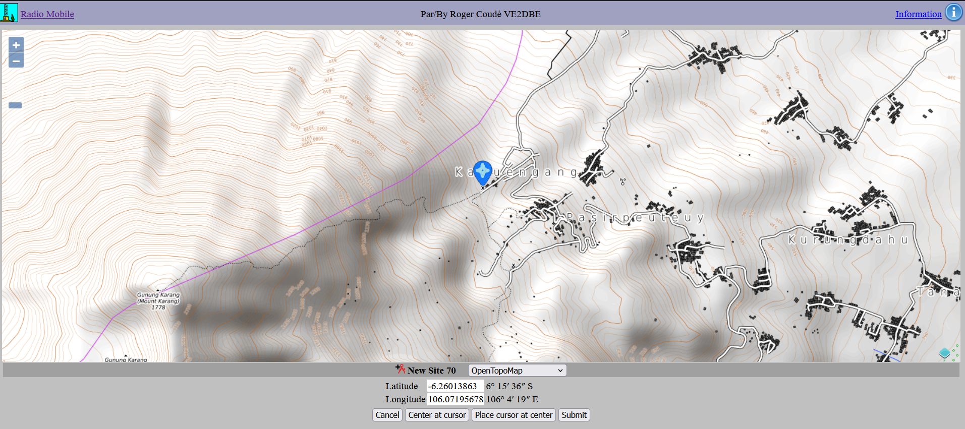
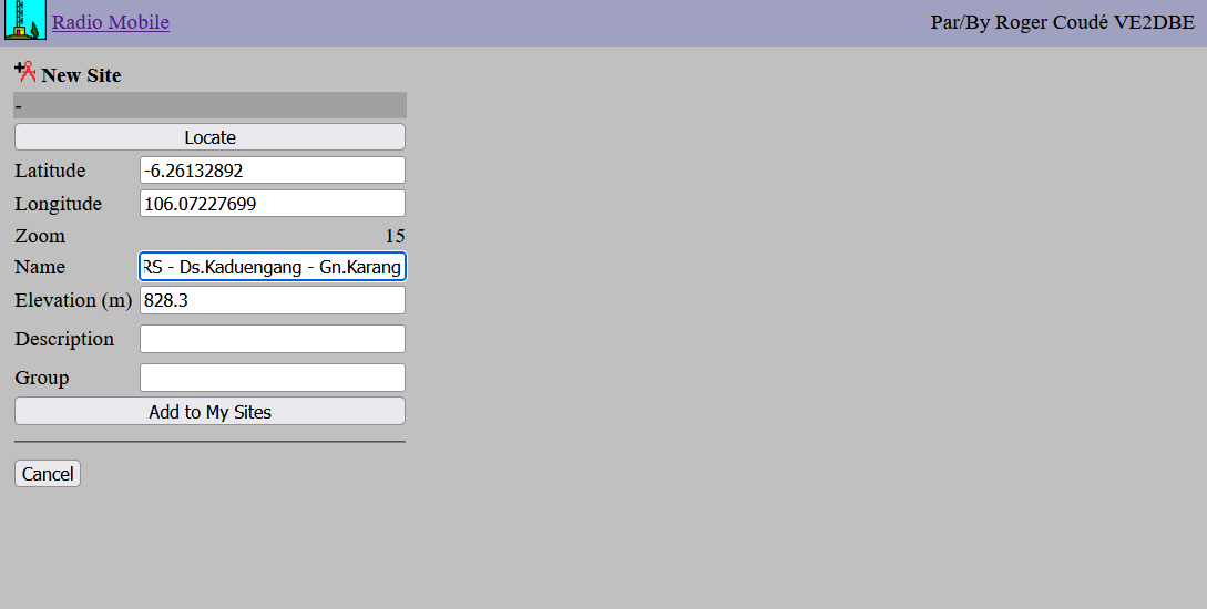
Navigate back to the main menu and click "New Coverage". Enter the following parameters based on our case study:
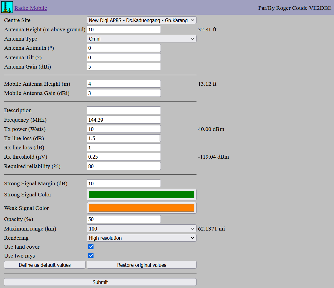
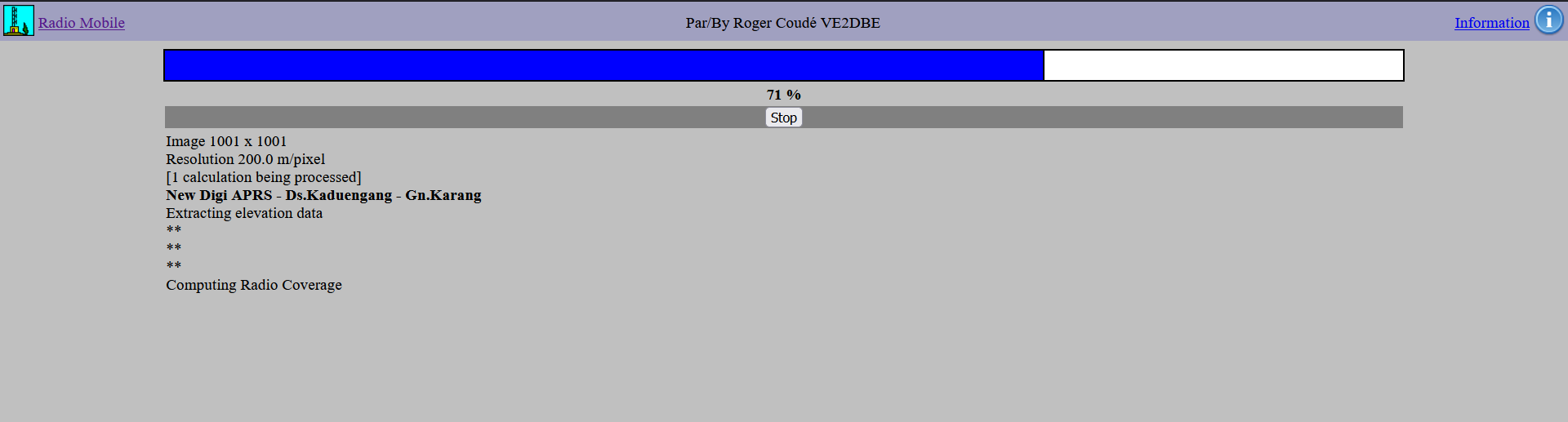
Click Submit and wait for the calculation to process.
Once the coverage map is generated, click "Add to my Coverage" to save it to your profile.
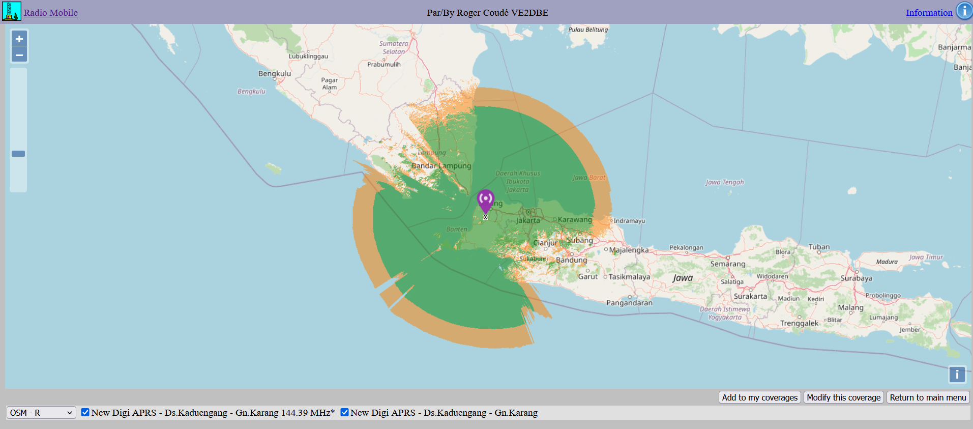
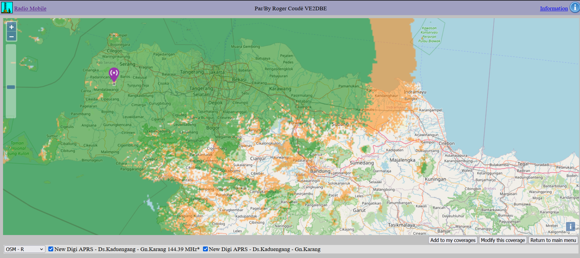
As you can see, from Mt.Karang Pandeglang, it can cover almost all of the Banten area, the Sunda Strait, Jakarta, Bogor, Karawang, a bit of West Lampung, and nearby regions.
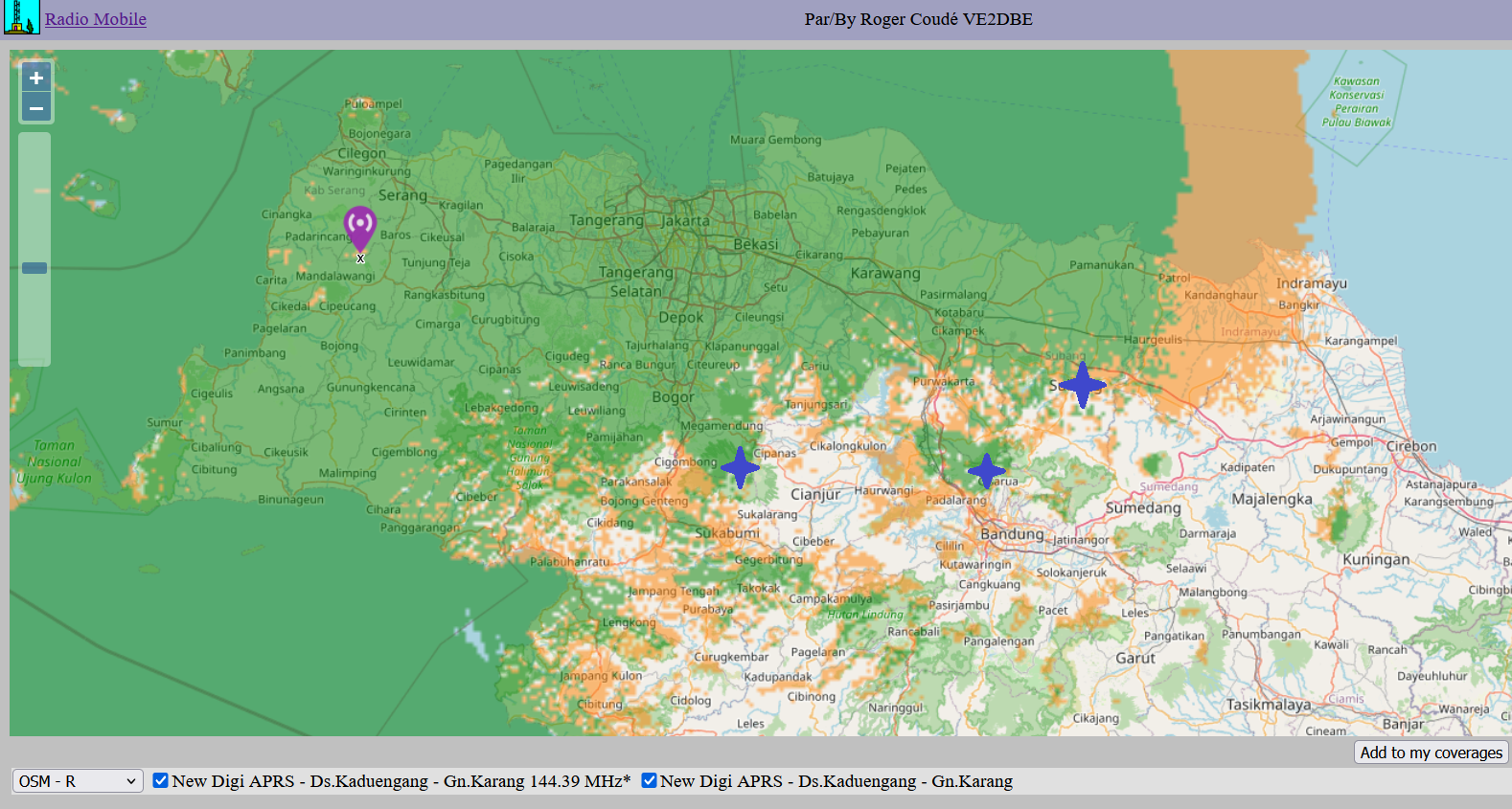
Planning Tip: To expand your network, choose new sites located within the orange (marginal) areas. This optimizes coverage overlap and reduces "dead zones" while maintaining redundancy.
This guide provides a basic workflow for evaluating radio repeater sites using Radio Mobile Online. By inputting accurate hardware parameters and terrain data, you can effectively predict performance before ever setting foot on the mountain.
Note: These results are for demonstration and should always be verified with on-site field testing.
73 de YB1SDL
Email: (handikogesang a t gmail com)
This page was handcrafted in plain HTML. No Java, No Flash.
Last Updated: February 17, 2026